Geographic Information Systems
GIS Webhosting Service
Data Capture/Conversion
Data Analysis
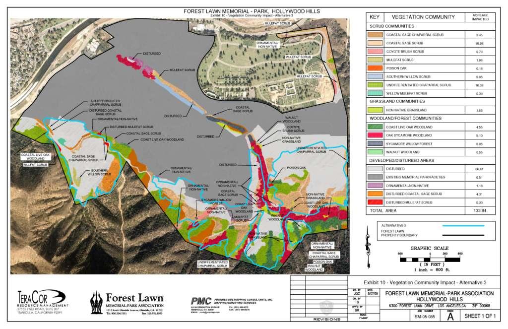
Exhibit Preperations
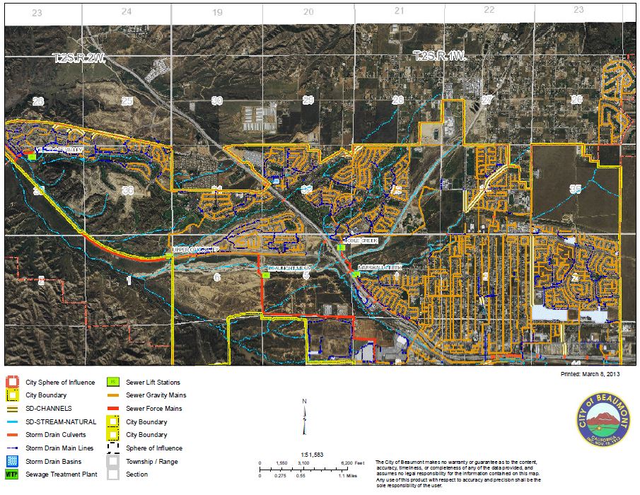
DJI offers a wide range of Geographic Information System (GIS) services. Our GIS professionals can provide assistance from initial planning to implementation and maintenance.
We specialize in providing GIS solutions for both the Private Land Development Projects and for Public Sector Municipalities and Utility Districts.
DJI's staff has expertise in state-of-the-art software and equipment. Solutions range from large Enterprise-Wide systems with GIS Web Hosting Services to small Web-Based data access points along with Data Analysis and Exhibit preparations.

- Needs Assessment
- Cadastral Base Mapping
- Data Conversion
- Water / Wastewater Base Mapping
- Document/Plan Scanning and Cataloging